Alum Cliffs Track – breathtaking in more ways than one
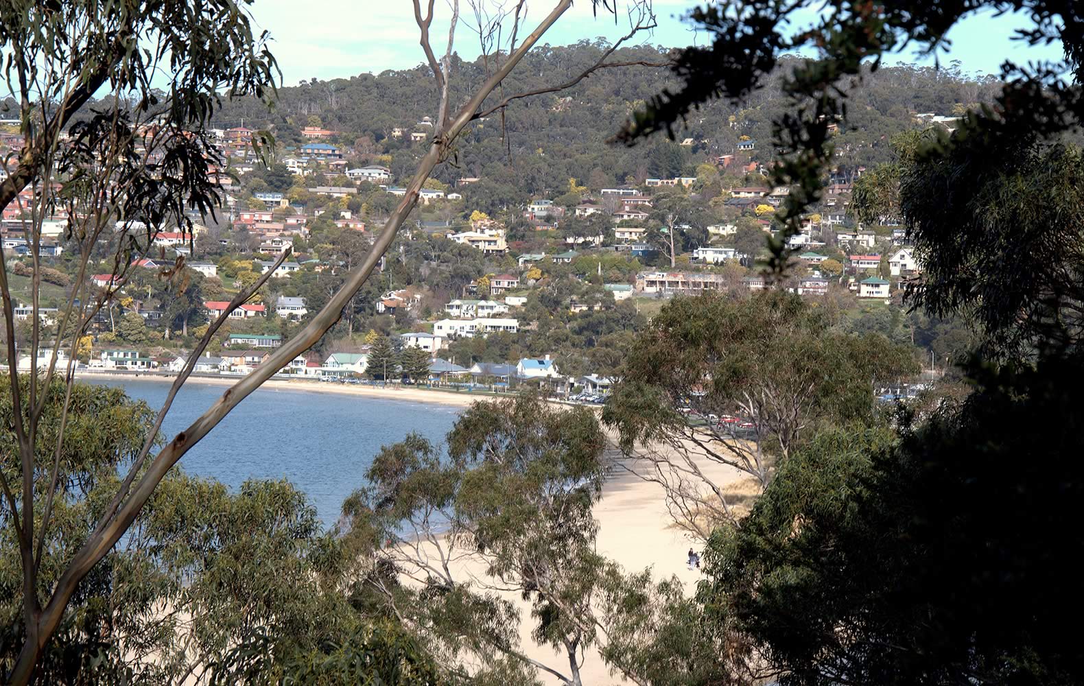
View of Kingston Beach from Alum Cliffs Track.
Image: Kingborough Council
by Peter Grant
What’s the best direction to walk the Alum Cliffs Track along the Derwent? That’s what I was wondering when a fine afternoon seemed to invite me to try the walk. As I was doing it by myself, a neat solution occurred. I could walk it both ways! That would not only solve the transport issue, it’d give me twice the walk distance.
That sorted I drove to the end of Taronga Road in Bonnet Hill, not far past Taroona’s Shot Tower. The track here is around 100m above sea level, and it wasn’t long before I was getting glimpses of the Derwent between the trees. After about a kilometre of easy undulating walking, the glimpses turned into a full-blown view. From a cleared and fenced lookout I was looking straight across the beautiful, broad Derwent estuary towards South Arm. An old tall ship, a modern yacht and a cargo vessel slipped slowly past, reminders of the continuing maritime story of the Derwent.
The track wound up and down, weaving inland through damper gullies before returning to the drier cliff tops. At various points fences protect unwary walkers from the steep cliffs that give the area their name. The “Alum” part of the name derives from the alum compound that was found in the local rocks.
The track was now trending downhill as it curved south-west towards Kingston. I tried to ignore the fact that my return trip would be mostly uphill. The views were a good distraction, with a large part of the Derwent estuary and Storm Bay stretching out before me. Below a group of sea kayakers hugged the shore, heading towards the cliffs.
Less than 3 km into the walk I could now see Tyndall Beach, best known as the Kingston Dog Beach, below me through the trees. Right on cue a couple walked by with their dog. Two more dogs weren’t far behind. With the popular dog beach below, and parts of the track open to off-lead dog walking, it’s no surprise that the track attracts dog owners. (Some sections of the walk are for “on-lead” walking: signs clearly indicate requirements.)
Above the dog beach I again had a choice. One steep track wound down to the beach, while another more evenly graded track lead to Tyndall Rd carpark, and Browns River. I took the steep track down to the beach, where a good number of humans and dogs seemed to be having some relaxing fun. But for me it was time to turn around, and do the walk in reverse.
In total the walk there and back was just shy of 6 km, and it had taken less than 2 hours. And which direction did I prefer doing the walk? To be honest each direction has its attractions, and I’d probably do the same again. But if I was walking with children or a group with mixed abilities, I’d be inclined to leave cars at both ends, and do the one-way, mainly downhill walk from Bonnet Hill to Tyndall Beach. If that wasn’t enough, a walk along Kingston Beach – with a café stop and a swim – or an even a longer walk on the Boronia Beach Track, would be good add-ons.
Wednesday 23 November 2016