Rod Surface Elevation Tables to measure ground level changes in the estuary
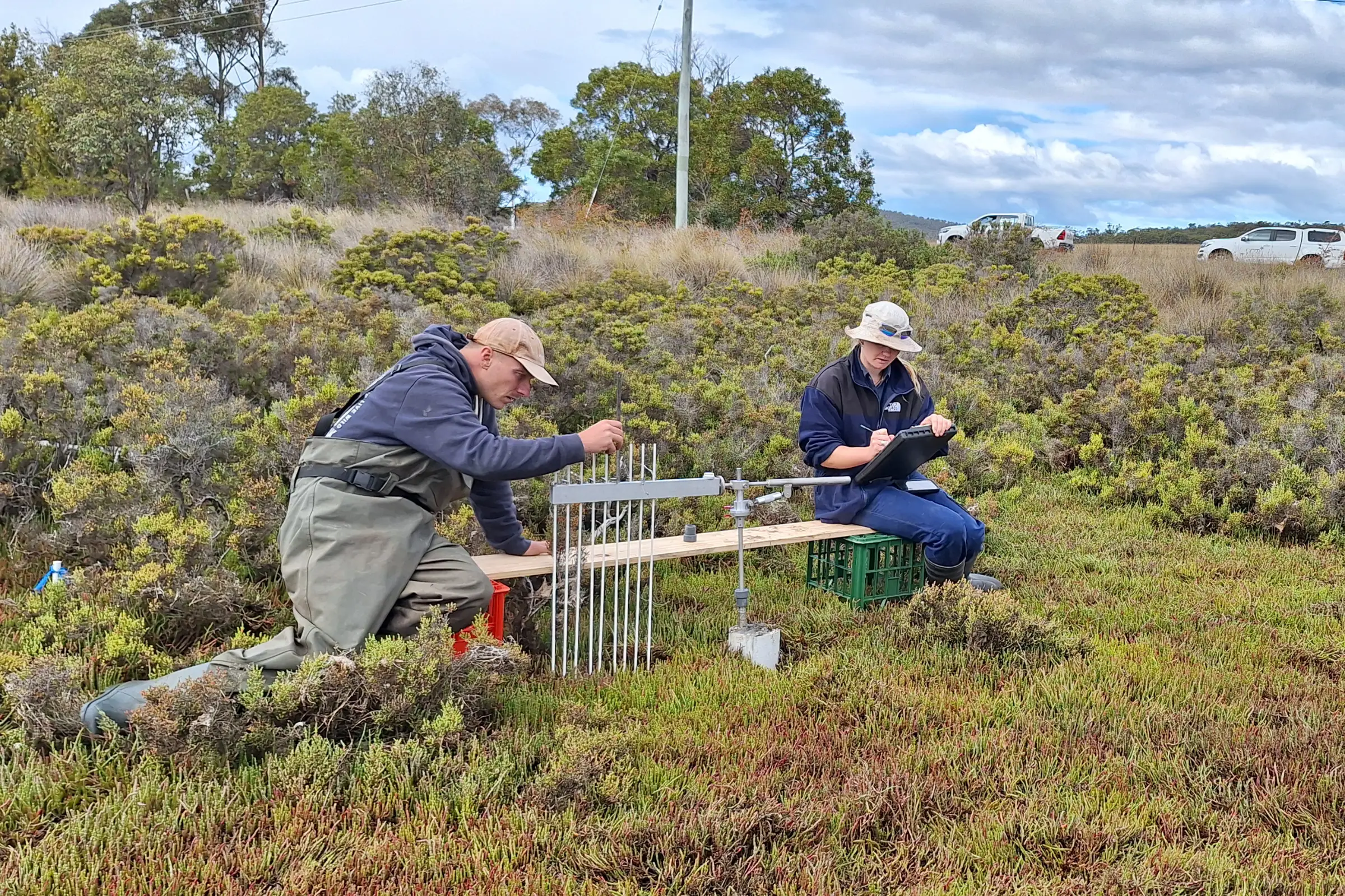
DEP and NRM South staff measuring ground level using RSET device.
Image: Derwent Estuary Program
We have been collaborating with NRM South and Australia’s Terrestrial Ecosystem Research Network (TERN) to install Rod Surface Elevation Tables (RSETs) into Tasmanian saltmarshes.
These RSET instruments were developed by the United States Geological Survey to measure ground level changes in tidal wetland areas in response to sea-level rise. As saltmarsh communities occur within the intertidal zone, they are particularly vulnerable to climate change impacts from rising sea levels. Sediment builds up in tidal wetlands from the water that passes through and plants can grow over this accumulated sediment, raising the ground level relative to sea-level rise.
Australia currently has a network of over 300 RSETs across tidal wetland areas, which are monitored for changes in tidal wetland elevation. This network is recognised as National Research Infrastructure and managed by TERN under the OzSET Project. Some of these RSET locations have been measuring ground level elevation changes for over 20 years!
A recent review of all the data collected by the Australian RSET network identified Tasmania as a key gap in the network, and the RSETs recently installed in the Derwent Estuary were the first to be installed in Tasmanian saltmarshes.
The team embraced the muddy conditions to install these RSETs across three sites in the estuary, as well as assisting NRM South to install some in their newly complete saltmarsh restoration site in Pitt Water–Orielton Lagoon
We will continue to monitor these RSETs over the coming years and report on ground level elevation changes in the Derwent Estuary and south-east Tasmanian tidal wetlands. This data will contribute to the national dataset of ground level elevation changes in Australia’s tidal wetlands. It will provide useful information to researchers and land managers about the health of tidal ecosystems and the risk to coastlines in the face of climate change and sea level rise.
Monday 20 April 2026